Routes & transport 1910s
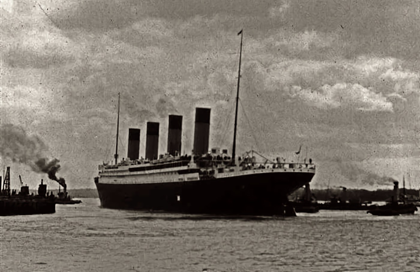
Titanic leaving Southampton
Titanic left Southampton on April 10, 1912, at the start of a scheduled Atlantic crossing. She called at Cherbourg and Queenstown before heading toward New York. Seen departing, the liner belongs to the busy world of ports, crews, migration and passenger travel that sustained the Atlantic route. The photograph’s later fame comes from the voyage’s end: Titanic struck an iceberg and sank on April 15. Passenger lists and maritime records bring the story back to the people aboard, whose reasons for making the crossing differed as sharply as their accommodations.
About the picture
The liner is shown leaving Southampton before the Atlantic crossing, with her four funnels and long hull visible from shore. Such departure photographs documented a regular commercial event. Knowing the ship’s fate changes how we look at the scene, but those aboard were beginning a voyage to New York.
The history behind it
What the archive establishes
The archive identifies Titanic leaving Southampton on April 10, 1912. The UK National Archives places Southampton before Cherbourg and Queenstown in the maiden-voyage sequence, with New York the intended destination. Belfast is therefore a plausible confusion with construction and trials; the later port calls belong to different moments. The photograph supports a harbor departure by an afloat liner, not a shipyard launch or the later rescue. Four funnels are not unique to Titanic: Olympic was a close visual relative, so the individual identity depends on provenance. The small craft should be read within the recorded port context rather than relabeled as lifeboats because the viewer knows what later happened. The exact departure date comes from the source, not from the cloud pattern or the number of funnels.
Date, place and phase
The record belongs to the maiden voyage’s English departure, before the French and Irish calls and the later Atlantic crossing. Southampton is the departure port identified by the archive and the documented route. Belfast concerns construction; Cherbourg and Queenstown were subsequent calls. The ship is afloat in a harbor departure scene. Its identity comes from provenance, while neither funnel count nor nearby small craft establishes a launch or rescue.
What the frame leaves open
The source identifies a departure. The mere presence of small craft does not transform an ordinary harbor scene into a disaster response. A four-funnel silhouette identifies a visible form, not the internal purpose of every funnel. This packet contains no machinery plan. Ships are also afloat in ports. Harbor movement, intermediate calls and open-ocean travel are distinct stages.
A few things to read next
Books for a longer visit, and a few good places to start online. These are ordinary links, with no affiliate commission.
On the bookshelf
A Night to Remember
A classic reconstruction of the sinking through passengers’ and crew members’ accounts.
How to Survive the Titanic or The Sinking of J. Bruce Ismay
The shipowner’s experience and the contested reputation that followed the disaster.
Bridging the Seas: The Rise of Naval Architecture in the Industrial Age, 1800–2000
The industrial shipbuilding history behind large iron and steel ocean liners.
Read online
RMS Titanic
A starting point for names, dates and related subjects. Follow its references when you want to go further.
Passengers on the Titanic
Use passenger records to investigate the voyage and the people making it.
RMS Titanic: fact sheet
A museum chronology of the ship, voyage and later discovery of the wreck.
Where the pictures come from
The original records and their individual rights statements are below. The pictures have not been generated or altered for the game.
Titanic leaving Southampton, April 10, 1912. Photographer unidentified in the source record.
Unidentified photographer, via Wikimedia Commons · 10 April 1912
Public domain
History notes and reading lists prepared for Then & Found with AI assistance. The source institutions and authors are not sponsors or endorsers. Suggest a correction or another source


