Ottoman cartography 1510s
Piri Reis and the making of an Atlantic map
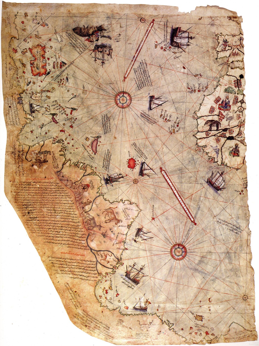
The surviving portion of Piri Reis’s 1513 world map brings Atlantic information into an Ottoman cartographic setting. Piri Reis was a seaman and compiler who combined earlier sources rather than claiming to have visited every coast himself. The parchment connects parts of the Americas with western Africa and Europe, using the coastal detail and visual language of maritime charts. Only a fragment of the larger map survives. Its fame rests partly on the way it preserves knowledge moving between people and empires during the decades after Columbus’s voyages, not on possessing a perfect modern outline.
About the picture
The parchment’s surviving edges tell us about the object’s condition, while the drawn coastlines tell us about its maker’s geographical sources. Piri Reis combined information of differing origins and quality. Reading the map historically means noticing this mixture rather than expecting every coastal shape to behave like a modern survey.
The history behind it
What the source establishes
The case turns on two kinds of incompleteness. The parchment is physically incomplete, and the knowledge represented on it was assembled from different cartographic inputs. A surviving edge therefore cannot be read as a clean original boundary of the world map, nor can a range of coastlines be transformed into a diary of Piri Reis’s own travels. The catalogue dates the work to 1513 and locates the surviving original at Topkapı. The image and supplied reading identify an Atlantic-focused fragment; precise claims about all lost regions would require evidence outside this packet.
Dates, places and close alternatives
1513 is the stated date of this map; nearby milestone dates belong to other records or voyages. The surviving coastlines frame the Atlantic, rather than a Pacific or complete Antarctic circuit. The evidence supports a fragment of a multi-source compilation, not an intact firsthand survey.
A missing area is not an empty area
The edge of a fragment records the survival of its material. It does not necessarily record a deliberate boundary drawn by the maker. Before reconstructing a lost whole, look for an independently documented copy, contemporary inventory or description that constrains what was once present. Simply enlarging the remaining image produces a bigger fragment. It does not create evidence for missing coastlines, dimensions or annotations.
A few things to read next
Books for a longer visit, and a few good places to start online. These are ordinary links, with no affiliate commission.
On the bookshelf
The History of Cartography, Volume 2, Book 1: Cartography in the Traditional Islamic and South Asian Societies
The Ottoman cartography chapters give Piri Reis’s work its closest scholarly setting.
The History of Cartography, Volume 3: Cartography in the European Renaissance
Compare Ottoman maritime mapping with contemporary European chartmaking.
A History of the World in 12 Maps
For an accessible account of maps as products of particular worlds of knowledge.
Read online
Piri Reis map
A starting point for names, dates and related subjects. Follow its references when you want to go further.
The Piri Reis World Map (1513)
An introduction to the surviving chart and its documentary importance.
Map of Piri Reis
A Turkish institutional overview of the map and its maker.
Where the pictures come from
The original records and their individual rights statements are below. The pictures have not been generated or altered for the game.
Surviving portion of Piri Reis’s 1513 world map.
Topkapı Palace Museum Library, H 1824; reproduction via Wikimedia Commons · 1513
Public domain; item record identifies the 1513 work and faithful reproduction as public domain.
History notes and reading lists prepared for Then & Found with AI assistance. The source institutions and authors are not sponsors or endorsers. Suggest a correction or another source


