Japanese cartography 1850s
Musashi Province on a woodblock map
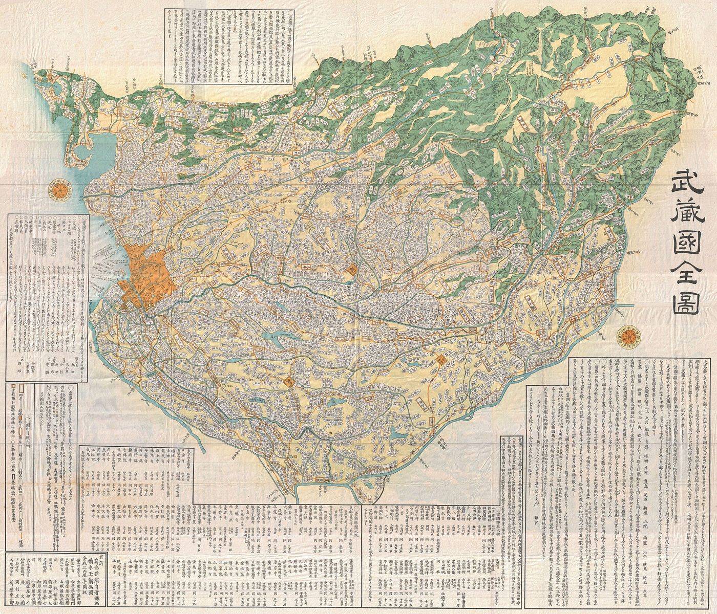
Long before Tokyo became the name of Japan’s capital, Edo stood within Musashi Province. The historical province also included land now in Saitama and Kanagawa. This woodblock map from the 1850s presents that region through place names, waterways and mountain profiles. Its lettering and pictorial features organise a reading experience that does not depend on a single north-up viewing position. Printed maps belonged to a busy culture of travel, publishing and local knowledge in late Tokugawa Japan. They offered readers a way to imagine connections between familiar places and more distant destinations.
About the picture
The mountains appear in profile, while labels turn to fit the sheet. These choices made sense within the map’s own reading conventions. Musashi was a historical administrative region, so its outline should be understood alongside Edo-period place names rather than treated as a modern prefectural boundary.
The history behind it
What the source establishes
The right answer preserves uncertainty instead of concealing it. A filename can be wrong, but so can a catalogue paragraph; this packet does not contain independent evidence to resolve 1856 against 1858. The shared 1850s date and late-Edo context remain usable. Likewise, a familiar modern city name is not a licence to substitute its present boundary for an older province. Musashi covered a wider region. Its mountains, coast and dense settlement labels belong to a cartographic tradition that does not require a fixed north-up page, rather than a single photographic viewpoint.
Dates, places and close alternatives
Both conflicting years fall in the 1850s, so the decade is defensible while an exclusive exact year is not. The subject is Musashi Province across several present-day administrative areas. The source warns against a fixed orientation; coast and place relationships are safer guides than assuming north-up.
Resolve only what the packet can resolve
When two source fields disagree, begin with the area on which they agree. Here the shared decade remains useful even though the exact year does not. Mark the remaining disagreement instead of choosing whichever field looks more convenient. Apply the same restraint to geographical reconstruction: use the older named province and stated drawing convention instead of importing modern boundaries and a north-up rule the source does not promise.
A few things to read next
Books for a longer visit, and a few good places to start online. These are ordinary links, with no affiliate commission.
On the bookshelf
Cartographic Japan: A History in Maps
Short historical studies connect individual Japanese maps with the lives and institutions around them.
The History of Cartography, Volume 2, Book 2: Cartography in the Traditional East and Southeast Asian Societies
The Japan chapters explain mapping conventions and the production of printed maps.
A History of the World in 12 Maps
For a broader comparison of how different societies have pictured geographical knowledge.
Read online
Musashi Province
A starting point for names, dates and related subjects. Follow its references when you want to go further.
Cartography in the Traditional East and Southeast Asian Societies
Free scholarly chapters include the history of cartography in Japan.
Woodblock map of Musashi Province
The original map and a description of its orientation and provincial geography.
Where the pictures come from
The original records and their individual rights statements are below. The pictures have not been generated or altered for the game.
Woodblock map of Musashi Province, dated to the 1850s in the source record.
Geographicus Rare Antique Maps / Wikimedia Commons · 1850s: filename and date field say 1856; descriptive paragraph says 1858
Public domain; item record marks the nineteenth-century map and faithful reproduction public domain.
History notes and reading lists prepared for Then & Found with AI assistance. The source institutions and authors are not sponsors or endorsers. Suggest a correction or another source


