Cities & construction 1930s
San Francisco before the bridges opened
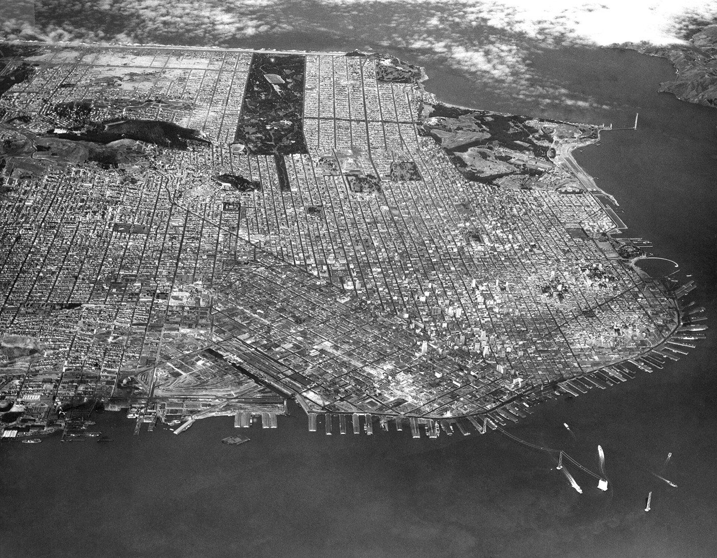
In July 1935, an aerial camera recorded San Francisco while two enormous bridge projects were changing its relationship with the surrounding bay. The Bay Bridge would open in 1936; the Golden Gate Bridge followed in 1937. Until then, crossing the water depended heavily on boats and ferries. From above, the city’s street pattern meets a shoreline shaped by piers, shipping and construction. This Navy photograph, later preserved in the NASA Ames archive, captures the interval when the new crossings were taking shape but had not yet become everyday routes.
About the picture
The Navy’s July 17, 1935, aerial view predates the openings of both major bay crossings. The construction stages place an unusually firm date around a changing city. From this height, streets and waterfront works become parts of one picture of transport, rather than isolated landmarks seen from the pavement.
The history behind it
What the archive establishes
The record identifies a Navy aerial made on July 17, 1935, looking west across South Beach and China Basin toward Golden Gate Park. It notes the Golden Gate and Bay Bridge works at the right of the view. NASA Ames is the preserving archive, not an institution claimed to have created this exposure in 1935. The correct phase predates either crossing’s opening: Caltrans dates the Bay Bridge opening to 1936, and the Golden Gate Bridge authority places that bridge’s opening in 1937. A familiar finished bridge should therefore not supply an automatic date for a construction image. The catalog’s orientation is more specific than recognizing San Francisco, but the fine works are small and should not be overinterpreted from a thumbnail. The phase and site answers combine the image with its documented provenance.
Date, place and phase
The Navy exposure is dated 1935, in the middle construction years. Its later NASA Ames custody does not supply the creation agency or move the exposure to NASA’s era. The catalog specifies a westward view across South Beach and China Basin toward Golden Gate Park. Recognizing the city alone is less precise than this documented orientation. Both crossings were still being constructed in 1935. The Bay Bridge opening in 1936 and Golden Gate opening in 1937 belong to later operational phases.
What the frame leaves open
The view runs inland from the South Beach and China Basin waterfront toward Golden Gate Park. The piers occupy the waterfront foreground, not the far side of the park. That is a real later sequence after the Bay Bridge opened in 1936. The source dates this exposure to 1935, before either crossing opened. The source identifies the creating agency and the later preserving archive. Those facts do not establish the exclusive commissioning purpose of the flight.
A few things to read next
Books for a longer visit, and a few good places to start online. These are ordinary links, with no affiliate commission.
On the bookshelf
California: A History
San Francisco’s transport projects within the state’s urban and economic development.
The Great Bridge
A comparison from New York: how another great bridge transformed a waterfront city.
The New Urban Landscape
The longer history of remaking American cities through public works and planned landscapes.
Read online
San Francisco–Oakland Bay Bridge
A starting point for names, dates and related subjects. Follow its references when you want to go further.
Golden Gate Bridge construction
A chronology of the work visible in the mid-1930s.
Caltrans history
The Bay Bridge opening and the wider development of California’s transport system.
Where the pictures come from
The original records and their individual rights statements are below. The pictures have not been generated or altered for the game.
Navy aerial of San Francisco, July 17, 1935. NASA Ames archive image ARC-1935-A93-0075-2.
U.S. Navy / NASA Ames Research Center, via Wikimedia Commons · 17 July 1935
Public domain
History notes and reading lists prepared for Then & Found with AI assistance. The source institutions and authors are not sponsors or endorsers. Suggest a correction or another source


