Infrastructure and landscape 1829
Philadelphia’s Fairmount Water Works, 1829
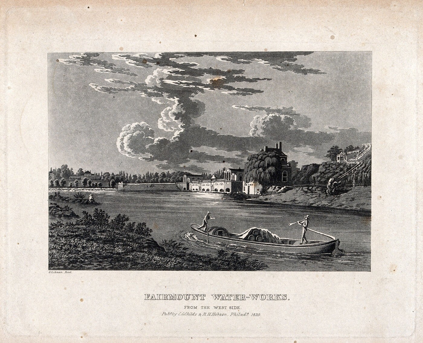
Philadelphia’s Fairmount Water Works opened in 1815 to pump water from the Schuylkill River into reservoirs above the city. Water could then travel downhill through the supply system. The site became famous for combining useful machinery with an attractive riverside setting, drawing visitors as well as serving households. George Lehman’s 1829 aquatint presents the works from the opposite bank, with boats and landscape framing the buildings. The peaceful scene belongs to an ambitious history of urban infrastructure: cities were learning to organize water supply on a scale that individual households could never manage alone.
About the picture
Lehman placed the waterworks within a broad river landscape, seen from the west side of the Schuylkill. The classical-looking buildings housed practical pumping operations. Views like this helped make public infrastructure into a civic attraction, presenting the city’s water supply as a place worth visiting and picturing.
The history behind it
The documented reconstruction
The correct caption is a west-side view of Philadelphia’s Fairmount waterworks in an aquatint published in 1829. Viewpoint, subject and publication are separately supported by the lettering and catalog. The boats and scenic presentation do not turn the work into a resort view, while the presence of substantial infrastructure does not date its inauguration. A technically important site can be represented as a landscape without providing machinery dimensions, water chemistry or an instantaneous record of river flow. Reading the plate’s actual viewpoint is stronger than inferring a bank from the direction in which an artist arranged a boat.
Reading the source
The aquatint offers scenic detail, but the plate lettering supplies the strongest evidence for viewpoint. That direct statement is more secure than a guess based on the way a boat faces. Publication, place and viewing direction are separate findings that happen to reinforce one another in this artifact. None automatically supplies an opening-day date.
Questions for further research
A landscape can preserve the appearance and cultural presentation of infrastructure while leaving its engineering operation largely unexplained. Without plans or measurements, it does not give every pump’s arrangement, water quality or instantaneous current. A researcher can use it as a located representation and then seek technical and institutional records for more specific operational questions.
A few things to read next
Books for a longer visit, and a few good places to start online. These are ordinary links, with no affiliate commission.
On the bookshelf
Water 4.0: The Past, Present, and Future of the World’s Most Vital Resource
An accessible history of how urban water systems evolved.
The Sanitary City: Environmental Services in Urban America from Colonial Times to the Present
The municipal institutions and engineering behind American water and waste services.
The New Urban Landscape
Why useful public works and attractive urban landscapes developed together in nineteenth-century cities.
Read online
Fairmount Water Works
A starting point for names, dates and related subjects. Follow its references when you want to go further.
History of the Fairmount Water Works
The pumping station’s construction, operation and later life as a public education center.
Fairmount Water Works
The engineering significance of steam pumping and later water power at the site.
Where the pictures come from
The original records and their individual rights statements are below. The pictures have not been generated or altered for the game.
Fairmont waterworks, Philadelphia. Aquatint by G. Lehman, 1829.
Wellcome Collection · Philadelphia : C.G. Childs & R.H. Hobson, 1829.
Public Domain Mark — free of known copyright restrictions.
An original editorial digest of the cited catalog facts; not a second historic eyewitness document.
Wellcome Collection · Editorial digest reviewed 2026-11-01
Original Data Barnacle wording summarizing factual catalog data; underlying artifact rights are stated on the image.
History notes and reading lists prepared for Then & Found with AI assistance. The source institutions and authors are not sponsors or endorsers. Suggest a correction or another source


